
A 45-minute warning delay between China and Nepal turned a Himalayan landslide into a regional catastrophe with 682 dead and nearly 3,000 missing.
A 45-minute warning delay between China and Nepal turned a Himalayan landslide into a regional catastrophe with 682 dead and nearly 3,000 missing.
A 45-minute warning delay between China and Nepal turned a Himalayan landslide into a regional catastrophe with 682 dead and nearly 3,000 missing.
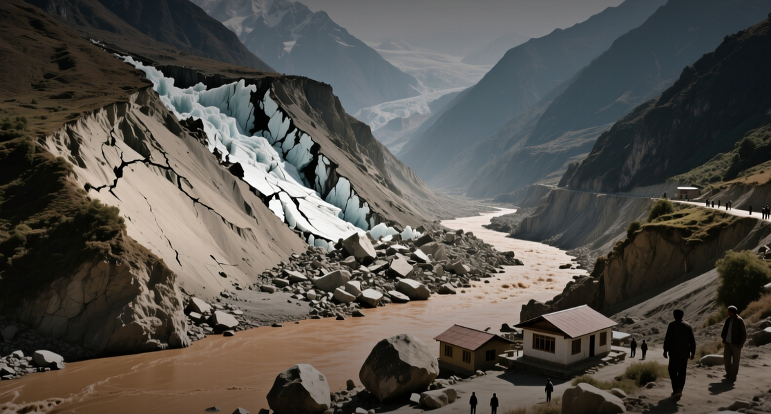
The flood that swept Nepal's Rasuwa district on Aug. 26 has killed 682 people with nearly 3,000 missing, exposing a 45-minute gap between when Chinese authorities detected the event and when Nepal received word.
"The nature of this disaster took time for both countries to fully grasp and had hit both nations hard," said Shisir Khanal, Nepal's foreign minister, who confirmed China has been "very forthcoming with sharing information and data" since the event.
The flood struck Tibet's Kerung county around 8:15 a.m. Nepal time on Aug. 26, but word reached Nepal's disaster authority only 45 minutes later — and not through any government channel but via a phone call from Rasuwa's Chief District Officer after locals spotted the rising river. Automated gauging stations at Bhote Koshi and Syabrubesi were among the first things the flood swept away, according to senior hydrologist Binod Parajuli. Formal notification from the Chinese side arrived only at 1:35 p.m., nearly five hours after the water crossed the border.
The disaster has destroyed or severely damaged at least 13 hydropower projects, with nearly 900 workers among the missing, and threatens to reshape how downstream states India and Bangladesh approach transboundary water cooperation with China. Nepal's reconstruction bill could run into "billions of dollars," Khanal said. The Upper Trishuli-1 hydropower plant, a $647 million project led by Korean companies including Doosan Enerbility, was engulfed, with nine Korean workers still missing.
Warning systems built for the wrong hazard
Scientists now believe the flood was triggered by the collapse of part of a glacier and the bedrock underneath on a mountain on Nepal's side of the border, not by a glacial lake outburst — the cause of a deadly flood last year. An avalanche of rock and ice crashed thousands of feet into the valley below, where it was crushed on impact and formed a muddy, debris-laden flood. The Chinese Embassy in Nepal said the country makes every effort to monitor Himalayan terrain for risks, but the task is complicated by the fact that risks are dispersed across the Himalayas, while a 2015 earthquake destabilized many rock masses on the southern slopes.
The distinction matters for preparedness. Lee Won-sang, principal researcher at the Glaciohydrology Research Center of the Korea Polar Research Institute, said early warning systems that monitor lake levels and dam conditions cannot detect sudden slope failures. "The biggest problem this time is that the slope that collapsed on the morning of the 26th was not being monitored at all," he said.
Data from the International Centre for Integrated Mountain Development show glacier loss across the Hindu Kush Himalaya has roughly doubled since 2000. A 2025 transboundary basin assessment flagged 28 glacial lakes as highly susceptible to outburst floods, and a separate study this year tracked one Tibetan lake's growth of 194 percent since 1975. None of this converted into an operating warning system, which is exactly the distinction the World Meteorological Organisation's four-part definition of early warning is built to expose: risk knowledge, monitoring and forecasting, communication, and preparedness to act.
Downstream states watch closely
For India and Bangladesh, both permanently downstream of the same glaciated plateau, Nepal's flood is a preview of a flaw underlying their own river relationships with China. India's Expert Level Mechanism on trans-border rivers, in place since 2006, was suspended after the 2017 Doklam standoff and revived only once relations eased the following year. Beijing approved the Medog mega-dam at the Yarlung Tsangpo's "Great Bend" in late 2024, a project expected to become the world's largest hydropower facility, and Chinese geologists published findings this July identifying an active fault line beneath the site. Arunachal Pradesh's Chief Minister Pema Khandu has called the project a "ticking water bomb."
Bangladesh is not party to the Expert Level Mechanism at all; it depends entirely on what Beijing shares with New Delhi and what New Delhi passes on. The 1996 Ganges treaty, born of the Farakka grievance, expires this December. India shares water-level, discharge, forecast and rainfall data with Bangladesh for designated stations on transboundary rivers, but the annual sharing period previously ended on 15 October — after the October 2021 Teesta flood, Bangladesh's Flood Forecasting and Warning Centre said it lacked the upstream Indian water-level data needed to issue a forecast.
The rescue effort continues. Nepal's Prime Minister Balendra Shah said 279 hydropower-plant workers had been rescued since Friday, with more than 100 workers possibly still alive and trapped inside tunnels at the Trishuli 3A and 3B sites. More than 500 foreign tourists, including 65 Americans, are among the missing in Nepal. In Tibet, 554 people remain missing, about half of them foreign tourists, according to state news agency Xinhua.
This article is for informational purposes only and does not constitute investment advice.
